As a scuba dive instructor diving in various locations and on many occasions, having the additional responsibility to provide an underwater tour to paying customers on dive sites I had never been on, the concept of an Ocean-Map seems like a real blessing!
That being said, I feel like all of the thousands of dive maps I’ve drawn in my lifetime have been pretty damn decent….But, what if?
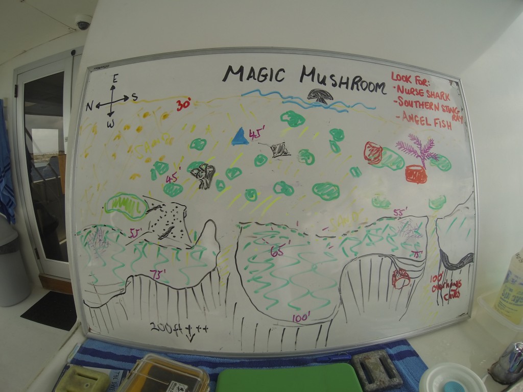
How many times have you attended a dive briefing and stared at the dive map that the divemaster has just drawn and struggled to translate that image to what it looks like in reality? Depending on your dive history, it could be a handful or even in the hundreds! As a scuba dive instructor, we learned how to give dive briefings and practiced drawing dive maps, but the reality is – artistic skills are not required to be a dive guide!
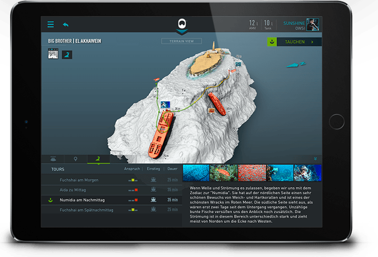
Now try to imagine yourself listening to a dive briefing, but this time, you’ve already checked out the dive map on your phone or tablet. However, this map will contain the intricate details of the underwater topography in 3D and colour. It lists the key features of the dive site and any obstacles to be aware of. In theory, it sounds a lot like those scribbled maps by divemasters, but it’s not. It’s way better. Like a million times better!
VS.

Interactive 3D dive map created by Ocean-Maps for the shipwreck "Big Brother" in El Akhawein in the Red Sea
Ocean-Maps is the first company ever to map the ocean floor and turn them into 3D interactive maps geared specifically for the recreational scuba diving industry. Based in Austria, they explore, measure and scan using sonar, satellite and video data, to present the real underwater world within a highly interactive environment! Their goal is to help scuba divers around the world plan their dives more safely through the use of highly detailed underwater ocean maps.
Ocean-Maps initially started by providing their unique skill set and equipment to prepare these detailed maps to commercial businesses such as power and water sanitation plants who require exact knowledge of what lies under the surface.
They use a variety of methods to get a precise view under the water’s surface. Their tools include Side Scan Sonars, a depth plotter, a precision GPS and a diving robot that may be equipped with a claw arm if needed. The robot is able to take high resolution images and videos of the ground and collect samples as deep as 300 meters underwater. All tools are carefully selected, considering depth and other special project requirements. This way they are able to survey and visualise the hidden underwater world – without taking unneccessary risk, or leaving space for errors of human action or perception.
Ocean-Maps are able to provide exact measurement and mapping of all surfaces underwater. Including scanning building structures underwater (like reservoirs, in/and outlets, power plants, piers, dam walls, and shipwrecks).
Ocean-Maps wanted to take things further and work with the dive community to make these detailed and interactive ocean maps for scuba dive sites around the world. So far, the company has mapped dive sites in Germany and Austria as well as 120 dive sites in the Red Sea. They have just finished mapping the entire Florida Keys through to Miami and are releasing these maps this November 2016! Never before have the most beautiful diving areas been made available in such detail. Now scuba divers are able to visualize underwater obstacles, drop offs, wrecks, hot spots and detailed briefing information all before they get in the water. Ocean-Maps is targeting California and the Caribbean in the future.
This is how it works:
3D Interactive Dive Maps – The App
Step 1:
Go to www.Ocean-Maps.com/Apps.html and download the App for free
Step 2:
There are In-App Purchases where you can buy certain reefs, or packages or you can buy the entire region. At the moment the company is considering implementing a subscription model where scuba divers can pay a certain amount each month and have access to everything. Would you be interested in this option?
3D Dive Cards
The 3D dive cards can be purchased at various scuba diving retail shops as well as online at www.Ocean-Maps.com. If you know of any retailers who are interested in having the Ocean-Maps dive cards in their shop, please don’t hesitate to get in touch, so the company can reach out to them.
In all honesty, I think these Ocean-Maps will revolutionize dive planning for scuba divers everywhere; however I am curious if they will take the mystery out of diving. There is a sense of excitement at exploring the unknown, but will knowing all of the details take away from this excitement? Speaking from experience, I am going to say “no, it will not”. The reason I believe this is because of the feeling I get every time I go to a dive site that I have already dived sometimes hundreds of times before. Maybe I know the underwater topography like the back of my hand, but every time I go, there is something different and unique to see with the anticipation that a chance encounter with a rare species could happen!
I can’t wait to see what Ocean-Maps comes up with in the future and am looking forward to seeing how their products will improve safety in the scuba diving industry. Check it out for yourself at www.Ocean-Maps.com


